
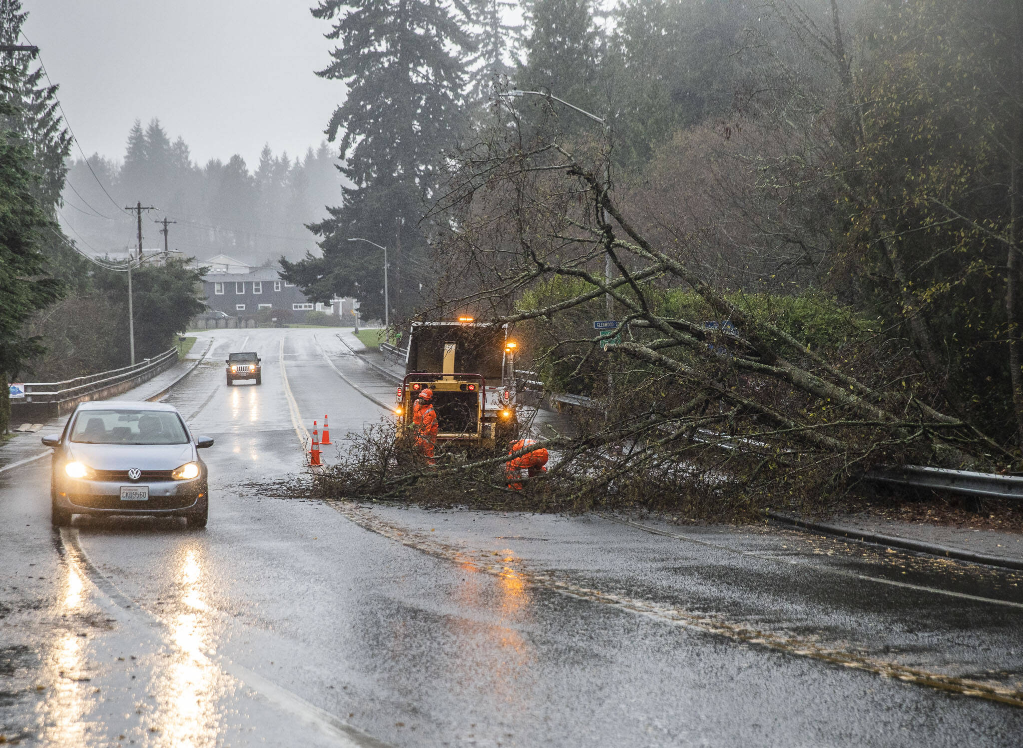
EVERETT — A weather system, known as a bomb cyclone, could deliver heavy winds, rain or snow and below freezing temperatures in Snohomish County on Tuesday.
A bomb cyclone happens when atmospheric pressure associated with the system drops dramatically in less than 24 hours. They’re less common, but the region has seen one or two a year in recent memory.
Even though the current system is currently on a direct path toward Vancouver Island, it will be felt by everyone — from Canada to northern California, said Maddie Kristell, a meteorologist with the National Weather Service.
“With that really strong low pressure, this is one to be aware of,” Kristell said.
For Snohomish County, that means sustained 30-35 mph winds with gusts up to 50-55 mph.
- Related

Bomb cyclone still on track to bring high winds to Snohomish CountyNov 19, 2024
To complicate matters, rare easterly winds will compound the effects of the storm, especially along U.S. 2 to Stevens Pass and other gaps through the Cascades where winds could top 60 mph.
The system will bring rain to the lowlands and snow in the higher elevations. For the west slopes of the Cascades above 2,500 feet, a blizzard warning was set to remain in effect from 4 p.m. Tuesday until 10 a.m. Wednesday. Areas affected by the warning, including Darrington, could see 4 to 12 inches of blowing snow.
“Driving could be very difficult to impossible,” the warning said. “Strong winds could cause extensive damage to trees and power lines.”
As for the timing for the western parts of the county, Kristell said winds will begin around 4 p.m. Tuesday and ramp up until about midnight, before subsiding Wednesday morning.
As if the wind and the rain weren’t enough, Kristell said temperatures will struggle to reach the mid 40s Tuesday before dropping to 29 to 32 degrees in certain parts of Snohomish County.
Michael Henneke: 425-339-3431; michael.henneke@heraldnet.com; X: @ihenpecked.
Talk to us
> Give us your news tips.
> Send us a letter to the editor.
> More Herald contact information.
